Maps of the Settlement
This page shows the two essential maps in understanding the Hamilton & Montgomery Settlement of 1606.
This map shows:
- the proximity of the Ulster and Scottish coastlines
- the lands of Lower Clandeboye, Upper Clandeboye and the Great Ardes
- the locations the settlers came from. (These locations are reproduced from Professor David Hackett Fischer’s Albion’s Seed, Four British Folkways in America, with the author’s personal permission.
- the direction of the migration, through Portpatrick to Donaghadee
- castles relevant to the story of the Settlement
- towns in Ulster relevant to the story of the Settlement
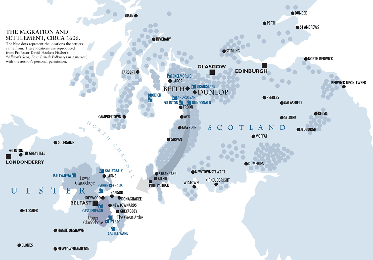
The Migration and Settlement, circa 1606.
This map is based on that shown in M Perceval Maxwell, The Scottish Migration to Ulster in the Reign of James I (London, 1973)
- Lands acquired by James Hamilton in brown
- Lands acquired by Hugh Montgomery in lilac
- Local council boundaries as of April 2006
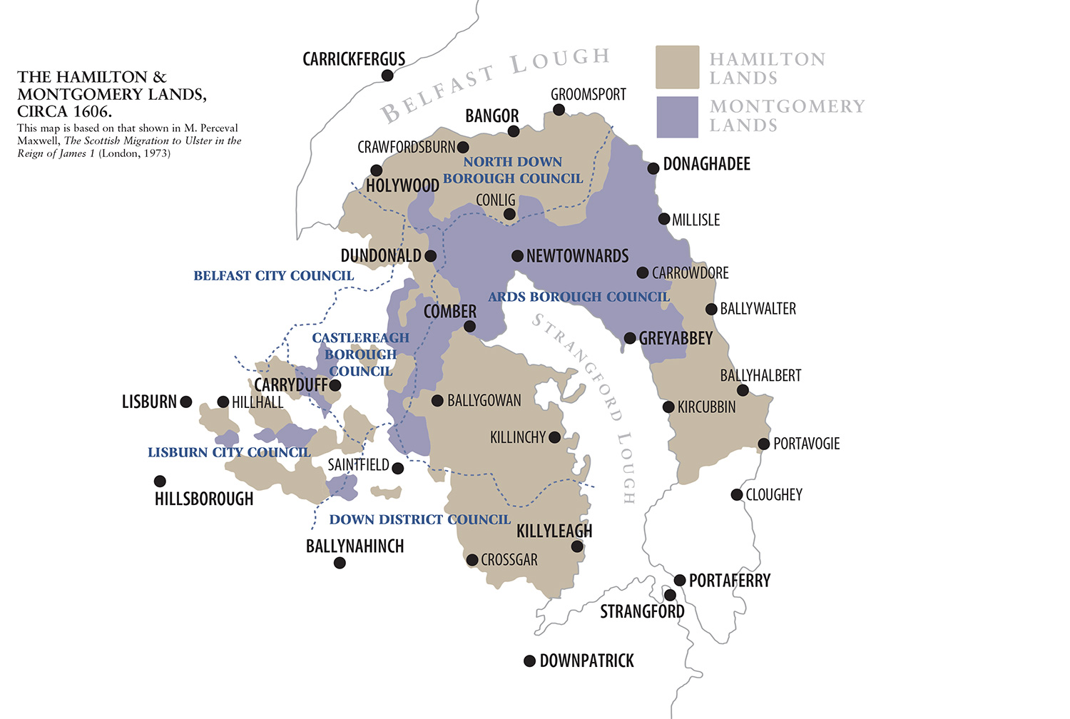
The Hamilton & Montgomery Lands, circa 1606.